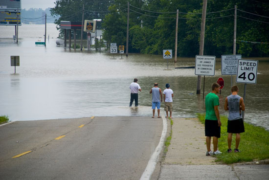
photo: Mike Slichenmyer/ thatothernewspaper.com
By David Colburn
Staff Writer
As the St. Louis area begins to stray from the harsh weather patterns of winter and into the tranquil climates of spring, a new concern emerges in the forecast: the potential of severe flooding.
The National Weather Service’s Significant River Flood Outlook map features an “Occurring or Imminent” classification for the southeastern portion of Missouri, and southern portion of Illinois, for the week of March 21 to March 27, 2011. In addition, flood warnings have been issued; for the Illinois River, at Hardin, Ill. ,and the Mississippi River, at Canton Lock and Dam 20, Mo.; Quincy, Ill.; Hannibal, Mo.; Saverton Lock and Dam 22, Mo.; Louisiana, Mo.; Clarksville Lock and Dam 24, Mo.; Winfield Lock and Dam 25, Mo.; and Grafton, Ill., as of March 23, 2011. As indicated by the National Weather Service’s website, the flood warning is “primarily a result of snow melt over the upper Mississippi River valley”.
Over the next 90 days, warnings will be in effect for all major rivers within the St. Louis area, but the Mississippi River is given primary concern. The National Weather Service Weather Forecast Office confirms the following statement; there are greater chances of major flooding along the Mississippi River this spring than in any Spring flood outlook issued in at least eight years. According to the Forecast Office’s Probabilistic Hydrologic Outlook, “the Mississippi will likely crest two to three feet higher than [the] same probabilities did two weeks ago thanks to additional ice and snow accumulation in Minnesota and Wisconsin”.
Heavy rainfall over the past few months also plays a significant role in the upcoming floods, as one would easily imagine. National Weather Service explains that the stream-flows of streams and smaller rivers in the St. Louis area were above their seasonal norms and soil moisture has generally increased.
Flooding of the Mississippi River has always been an issue of concern. According to gatewayno.com, efforts to contain the river have been much more vigorous since a 1927 flood near Cairo, Ill., in which 26,000 square miles of land were inundated and the river rose 57 feet. The severity of the situation led to the construction of artificial levees and dredged waterways by the federal government.
How can one remain safe in the approaching floods? The National Weather Service’s “Turn Around Don’t Drown” campaign provides the following tips; monitor the radio for vital weather updates, get to higher ground, avoid areas that are already flooded, refrain from parking vehicles along streams or washes during threatening conditions, and exercise greater caution at night.


